Discover properties and locations with advanced geospatial mapping solutions
HomeMaps & RealEstate
Real Estate Applications
ScaleOrange Maps can empower real estate businesses to make smarter decisions and
create
more engaging customer experiences:
Identify high-growth localities with precise boundary and infrastructure data
Visualize nearby schools, hospitals, transport, and amenities for property listings
Showcase project layouts and neighborhoods with interactive maps
Use offline maps during field surveys for site assessments
Enhance property marketing with geo-enabled visualization tools
App Preview
Get a visual walkthrough of our intuitive mapping interface
App Description
Who Can Benefit from ScaleOrange Maps?
ScaleOrange Maps offers detailed political and geospatial visualizations,
enabling real-time data insights across districts, wards, localities, and points of
interest.
The app is built for:
Government officers & planners needing accurate administrative maps
Analysts requiring geographic breakdowns for development metrics
Educational institutions for academic research and visualization
NGOs and volunteers working on rural and urban development
Civil engineers and survey teams conducting field assessments in offline environments
Citizens or journalists understanding political boundaries like assembly and
parliamentary constituencies
Real estate developers & property businesses for site selection, neighborhood mapping,
and showcasing projects with accurate geo-visualization
Key Features
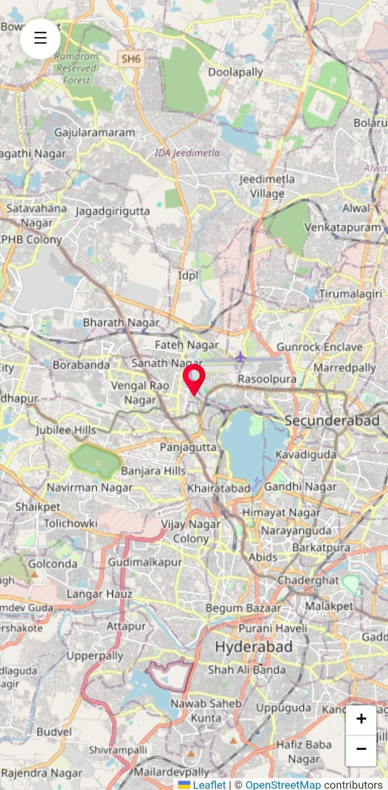
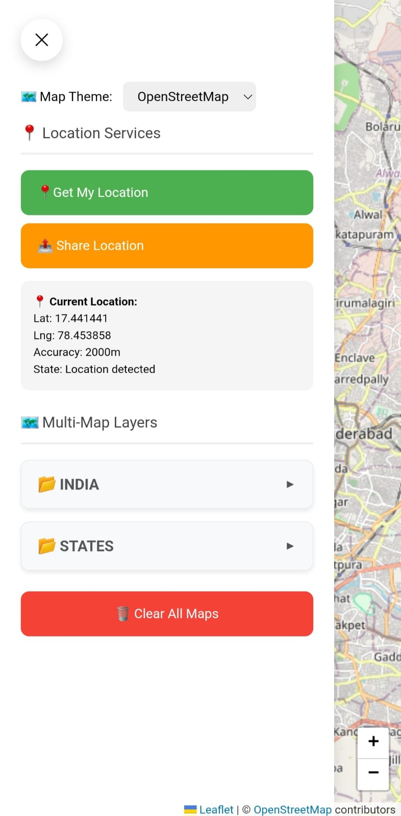
View your current GPS location on the map
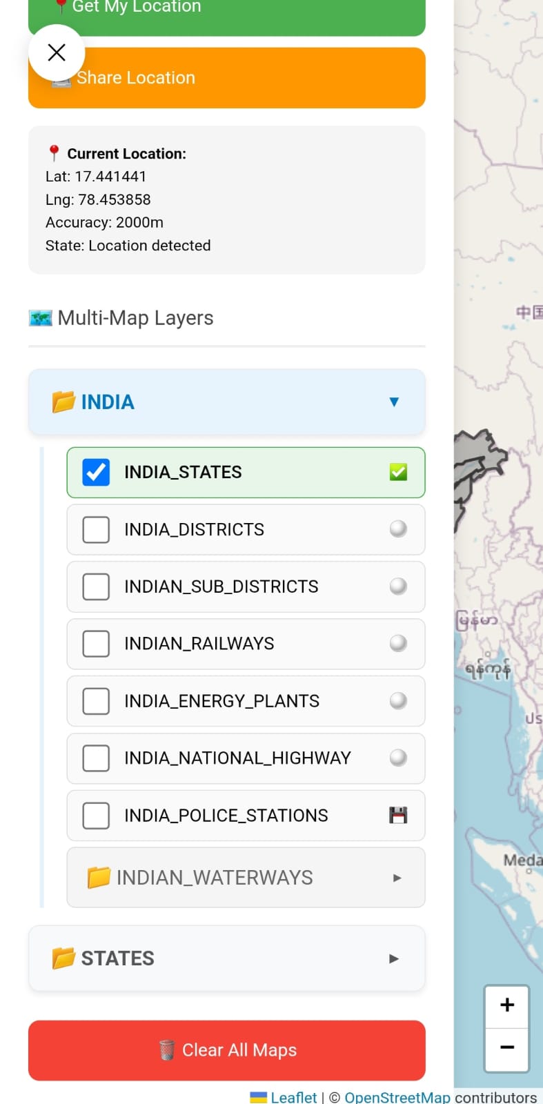
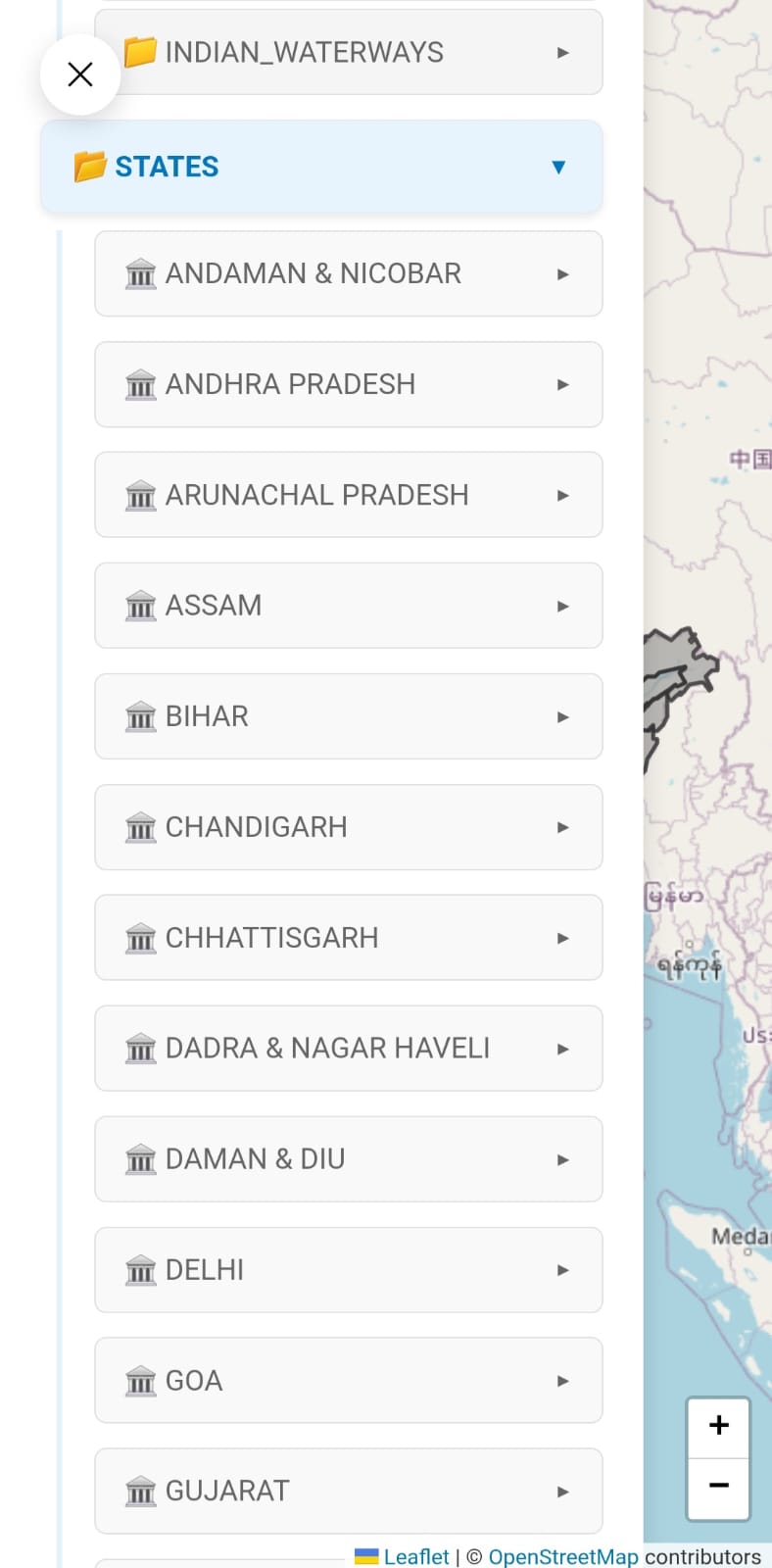
Access detailed administrative boundaries: states, districts, sub-districts, and constituencies
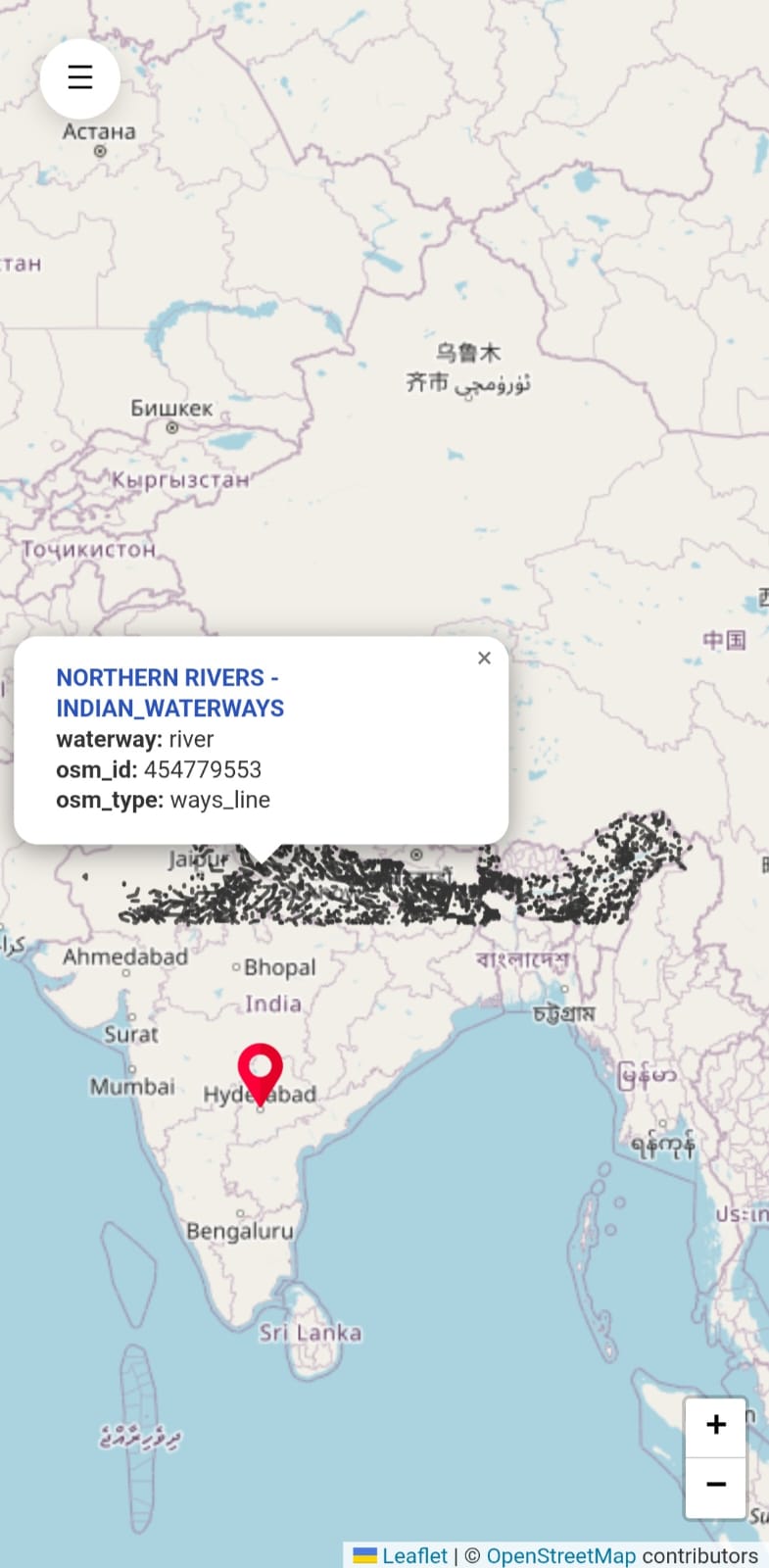
Visualize railways, waterways, and other infrastructure layers
Toggle between multiple map layers with an intuitive selector
Cache map data offline for field work and remote areas
Faster rendering via smart memory caching
Seamless updates: new map layers can be added without app updates
Works on both web browsers and Android devices
How It Works
GeoJSON Data Source: Administrative layers like states, districts, railways, and
constituencies are stored as lightweight map files, ensuring fast and easily
maintainable maps.
Dynamic Data Linking: The app reads all map layer sources from a single configuration,
allowing effortless updates to map
sources without code changes.
Efficient Caching: Loaded map layers are cached locally, minimizing repeat downloads
and enhancing performance for larger datasets.
Offline Support: On mobile devices, map data is stored
locally, enabling faster load times and basic offline support for field work.
Multi-Layer Map Support: Users can toggle multiple overlays, like sub-districts and
railways, using an intuitive interface.
Location Awareness: The app accesses the user's current location and auto-centers the
map, helping users explore nearby regions accurately.
How to Use the App
Install the app from Google Play or open it in your browser
Tap on "Locate Me" to view your current location on the map
Use the map selector to toggle layers like States, Districts, Railways, Waterways
Switch between political, infrastructure, or administrative boundaries
Works offline: cached files are stored securely for field use
Developers can extend or replace layers by updating the configuration file with their own
sources